Florence Oltrarno: complete neighbourhood guide
Geography and boundaries
Oltrarno occupies the south bank of the Arno within the historic city walls. Its northern perimeter is the river, crossed by five bridges: Ponte Vecchio, Ponte Santa Trinita, Ponte alla Carraia, Ponte Amerigo Vespucci to the west, and Ponte alle Grazie to the east. The river is not just a geographic boundary but a functional one, crossing it has always marked a change of character, density, and social composition.
The western boundary follows the city walls to the Porta San Frediano, a 14th-century gate on Via Pisana. The east end of the neighbourhood is less sharply defined: the area around Piazza Poggi and Via dei Renai transitions gradually into the Niccolò and Bardini districts, which share Oltrarno’s character but are considered separate by longtime residents. The southern boundary is the hill: the land rises steeply once you move a few hundred metres from the river, climbing toward Forte Belvedere, the Boboli Gardens, and the residential ridge above.
The flat strip along the river between Ponte Vecchio and Porta San Frediano is approximately 1.2 kilometres long and at most 500 metres deep before the slope begins. This compressed area, roughly the size of 60 city blocks, contains the commercial streets, the major squares, the neighbourhood churches, and the artisan workshops.
The historical layers of the south bank
The Romans built Florence (Florentia) as a military colony around 59 BC, centred on the north bank. The south bank was then rural, used for farming and connected to the city by a wooden bridge roughly where Ponte Vecchio now stands. The bridge was rebuilt in stone in 972 AD and again several times after flood damage. The current Ponte Vecchio dates from 1345.
The south bank was enclosed within city walls for the first time in the 13th century, as Florence expanded beyond its earlier boundaries. The walls built in this period, the third ring of Florentine walls, enclosed a population that was already working-class in composition: artisans, tanners, wool-workers, and the labourers who supported the city’s export textile industry. The neighbourhood’s identity as a place of manual production rather than civic administration was established in this period and has never been entirely overwritten.
The Medici intervention in the 16th century imposed a layer of aristocratic architecture over this working base. When Cosimo I moved the court to Palazzo Pitti in 1560, the streets around it filled with palaces built for nobles and wealthy merchants who needed proximity to power. Via Maggio, one of the main arteries running west from Ponte Vecchio, acquired its current character, large palace facades, ground-floor antique dealers, occasional glimpses of inner courtyards, during this period. But the Medici court occupied only part of the neighbourhood. West of Piazza del Carmine and south of Via Serragli, the artisan character remained dominant.
Social composition in the 21st century
Oltrarno in 2026 is in the middle of a long-term demographic shift that has been accelerating since approximately 2010. The resident population has been declining as properties convert to short-term rental use and as rents for conventional apartments have increased. The city of Florence as a whole has lost roughly 50,000 residents since its population peak in the 1970s; the historic centre, including Oltrarno, has seen the sharpest losses proportionally.
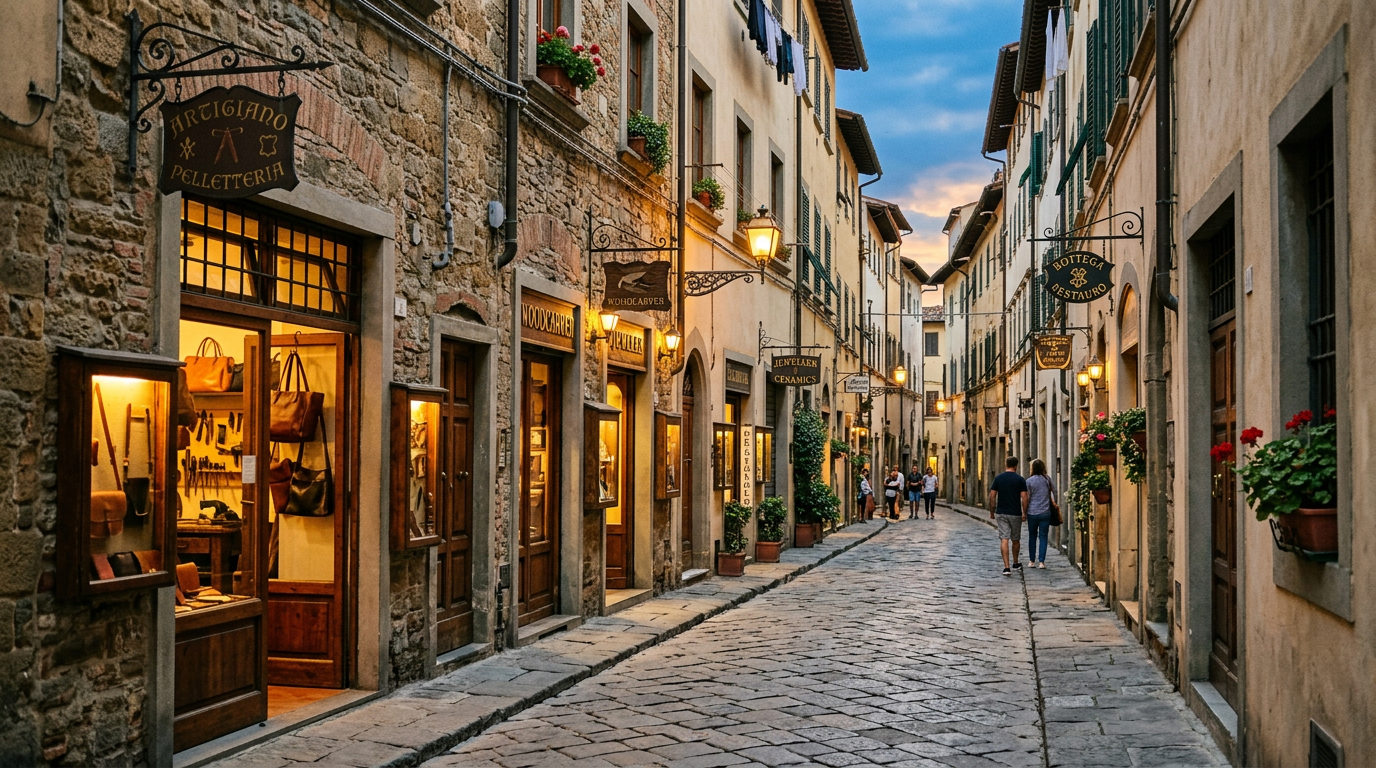
Despite this, Oltrarno retains a higher proportion of long-term resident Florentines than most of the historic centre north of the Arno. The neighbourhood associations (comitati di quartiere) are active and vocal on issues including short-term rental density, traffic, and the preservation of artisan activities. The Associazione OltrArno Artigiani, which represents workshop owners, estimates that approximately 150 active craft businesses remain in the neighbourhood, a significant decline from the several hundred operating in the 1980s, but enough to maintain a visible and functioning artisan economy.
The social mix you encounter on the street reflects this tension. Via Maggio and the streets immediately around Palazzo Pitti have shifted substantially toward tourism: the shops sell leather goods and prints, the restaurants have menus in four languages, and the people you see at midday are predominantly visitors. Three streets away, on Via dell’Orto or Borgo Tegolaio, the reality is different: a carpenter’s workshop, a bar where no one speaks English, a hardware store that has been in the same family for forty years.
The main squares and their functions
Piazza Santo Spirito is the neighbourhood’s social centre and has been for centuries. The square is anchored by Brunelleschi’s basilica at its southern end and enclosed by a mix of residential buildings and ground-floor businesses, cafes, wine bars, and small restaurants, on the other three sides. A morning market operates from Monday to Saturday, selling vegetables, fruit, and bread from producers in the surrounding countryside.
The atmosphere in Santo Spirito is democratic in a way that few Florentine squares achieve. On a summer evening, you will see retired Florentines on benches, students with wine glasses on the steps of the basilica, foreign visitors at restaurant tables, and groups of Africans and South Americans who live in the neighbourhood and use the square as a meeting point. The piazza is not sanitised or formally tourist-oriented; it functions as a genuine public space.
Piazza del Carmine, 400 metres west of Santo Spirito, is quieter and less self-conscious. The basilica of Santa Maria del Carmine faces it on the west side. The square has a neighbourhood pharmacy, a bar that opens at 7:00 for workers’ breakfasts, and a small supermarket. It is not on any tourist itinerary and has no particular visual drama. Its interest is exactly its ordinariness: a Florentine neighbourhood square functioning as it has for two hundred years.
Piazza de’ Pitti, directly in front of Palazzo Pitti, is the most formally tourist-oriented of the neighbourhood’s squares. The vast pietra forte facade of the palace dominates the north side. The square is used for outdoor events and occasional concerts. On a busy summer day, it is crowded. Early in the morning, before the museums open, it has a different quality: empty, large, and impressive in a way that the crowds obscure.
Practical information for visitors
Oltrarno is accessible on foot from the north bank of the city via any of the five bridges. The walk from Piazza della Repubblica to Piazza Santo Spirito via Ponte Vecchio and Via Guicciardini takes approximately 15 minutes. From Santa Croce via Ponte alle Grazie and along the Lungarno Serristori takes about the same time.
No bus line penetrates the interior streets, which are too narrow for standard-size buses. The ATAF bus lines serving Oltrarno run along the major arteries: the 11 and D lines serve the Lungarno on the south side; the C3 runs along Via dei Serragli and Via Romana toward Porta Romana. The Tramvia T1 line, which connects Santa Maria Novella station to Scandicci, passes through the western edge of the neighbourhood near Porta San Frediano.
Parking is limited and subject to restricted zone regulations (ZTL) that cover the entire historic centre. Visitors arriving by car should use the Piazzale Michelangelo car park, which is free and located at the eastern edge of the neighbourhood on the hillside, or the Oltrarno car park on Viale Giannotti, which charges a daily rate. Walking from either to the centre of Oltrarno takes 10 to 15 minutes.
Where to stay
Being based in Oltrarno means experiencing the neighbourhood on its own terms, at market time in the morning, at lunch in its trattorias, in the evening at the square. For visitors who want this kind of integrated stay in the south bank, De’ Medici offers accommodation at the heart of the historic Oltrarno district.